History of the Rupununi
The Rupununi’s human story begins at the end of the last Ice Age. Paleo-Indian hunters first reached the region between 10,000 and 12,000 years ago. They were hunting game across the savannas of what is now southwest Guyana. They found a landscape that was already ancient. It was shaped by two billion years of geology. Rivers carved it, and seasonal floods transformed it. These floods connected habitats and drove extraordinary concentrations of wildlife.
The first peoples
Archaeological evidence records a continuous human presence in the northern Rupununi spanning thousands of years. Early hunter-gatherers exploited forest and savanna resources, including the seasonal fisheries created by the annual floods. Rock carvings — petroglyphs — are found throughout the area, carved into rocks at river crossings and fishing sites. These carvings are among the most visible legacies of the region’s earliest inhabitants.
About 3,500 years ago, communities in the region developed more complex land-use strategies, cultivating cassava on nutrient-poor tropical soils. The ability to process toxic cassava into fariña, bread, and fermented drinks was a major technological achievement. This innovation shaped settlement patterns across the Guianas.
The Makushi arrive
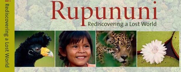
The Makushi are a Carib-speaking people. They live today in both Guyana and Brazil. They established themselves in the northern Rupununi well before European contact. They called the Takutu Basin Piyikwiti, meaning ‘place of landings’, a reference to the ease of river access. The region is also known as Rupununi. It derives from the Makushi word rapon. This word refers to the black-bellied tree duck found along the river.
Early Makushi communities were semi-nomadic, organized around family groups, and renowned for their knowledge of the forest, savanna, and water. They produced high-quality curare. This was a plant-based paralytic used in blowpipes. It was traded widely across the Guianas. The curare attracted early European attention from the sixteenth century onward.
The European explorers
The first Europeans to describe the region were drawn by the myth of El Dorado. This was the legendary city of gold said to lie in the interior of South America. In 1595, Sir Walter Raleigh explored the Essequibo and Orinoco rivers. He described a ‘great and golden city.’ Yet, this city was never found. The legend persisted, bringing later expeditions deeper into the continent.
Robert Schomburgk was commissioned by the Royal Geographical Society. He made the first systematic survey of British Guiana between 1835 and 1839. He mapped rivers and mountains and recorded natural history. His boundary surveys — the Schomburgk Line — shaped British Guiana’s territorial claims for generations.
Charles Waterton visited the Rupununi in the early nineteenth century. He wrote memorably of the Surama savanna: ‘The finest park that England boasts falls far short of this delightful scene.’ His natural history writings helped create the region’s literary reputation. Everard Im Thurn was the most celebrated explorer of the Rupununi’s mountains. He was a botanist and colonial administrator. In December 1884, he led the first successful ascent of Mount Roraima. This is the great flat-topped tepui that rises nearly 3,000 meters above the surrounding savannas. His description of the summit offers a bizarre cloud-bound landscape. It features strange plants and insects. This account directly inspired Arthur Conan Doyle’s 1912 novel The Lost World. In the novel, a scientist discovers living dinosaurs atop an Amazonian plateau. The Rupununi and its mountains had entered world literature.
The twentieth century
The twentieth century brought cattle ranching, mission schools, and new connections to the coast. The Hart and McTurk families became central figures in Rupununi life. Diane McTurk of Karanambu became internationally known for her giant river otter rehabilitation program. It was among the first conservation efforts in South America.
Filmmakers and naturalists visited during the mid-twentieth century. Gerald Durrell and David Attenborough were notable visitors. They produced films and books that gave the region a brief international profile. Since the 1970s, relatively little has been written about the Rupununi — one reason this book and website exist.
The Rupununi today
The Rupununi today is at a crossroads. Its population is among the fastest-growing in Guyana. New roads are opening access to formerly remote areas. The Government of Guyana’s Low Carbon Development Strategy focuses on the intact forests of the interior. These forests are central to national climate and biodiversity policy. Guyana was the first country certified under the Architecture for REDD+ Transactions. It was also the first to sell forest carbon credits under this standard. The country received US$187.5 million by early 2024.
In 2025, Guyana launched the Global Biodiversity Alliance in Georgetown. Indigenous leaders from the Rupununi were among the signatories to the Georgetown Declaration. The Rupununi was named as a model region for community-led biodiversity governance.
Explore the Rupununi
The human story of the Rupununi is inseparable from the land itself. The ancient geology of the Guiana Shield shaped the savannas and mountains that the Makushi people call home. The extraordinary wildlife of the Rupununi — including giant river otters, arapaima, and jaguars — thrived because of this same landscape. Learn more about the Makushi people and their living culture today, meet the authors of this book, read the latest on the Rupununi Blog, or return to the home page.