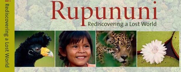
The Rupununi in the World’s Imagination
Historical Narrative, Global Standing, and Policy Stakes
I was the director of the Charles Darwin Foundation from 2004 to 2008. When I interviewed for the role in 2003, I was met by barbed wire and the threat of Molotov cocktails. Between 2003 and 2007, governance broke down as conflicts over fisheries escalated, alongside rapid tourism growth, migration, and the spread of invasive species. That experience taught me how quickly a conservation site’s global standing can rise or collapse.
Over roughly 50 years, the Galapagos became a global reference point—built initially on Charles Darwin’s 1835 visit and reinforced by decades of books, articles, and films. It was Ecuador’s most internationally visible environmental asset, and the government acted once the political and reputational costs crossed a threshold. In April 2007, the President issued a decree declaring conservation and management of the Galapagos a national priority, driven by the fear that the world’s most famous conservation site could fail.
The Rupununi is increasingly known for its biodiversity and for successes in community-based management. Writers and filmmakers shape international awareness through the works they leave behind. As a result, policies that affect the Rupununi will be assessed not only at home but also through comparisons—explicit and implicit—with other iconic places. In this sense, the Rupununi, like the Galapagos, can function as a strategic asset or a liability, and decisions taken there can strengthen (or weaken) Guyana’s global standing and partnerships beyond its borders.
That reality sits alongside legitimate national and local priorities: livelihoods, services, connectivity, investment, and the practical needs of communities that live in and depend on the landscape. The challenge—and opportunity—is to pursue development in ways that keep the Rupununi’s ecological integrity and Indigenous governance strengths at the center, so that growth reinforces (rather than erodes) the asset that draws attention and value in the first place.
The history of a place creates reputational and diplomatic exposure, and it can attract sustained interest and attention. Once places acquire global standing, they are no longer governed solely through domestic policy choices; decisions reverberate through markets, media, and international partnerships. This blog examines the Rupununi in global literature—and how that record has shaped outside narratives and, in turn, the context for managing the region today. This blog is for Guyanese decision-makers and citizens, as well as for others with an interest in the Rupununi who want to understand how these narratives evolved and why they matter today.
Myth, Science, and Indigenous Knowledge
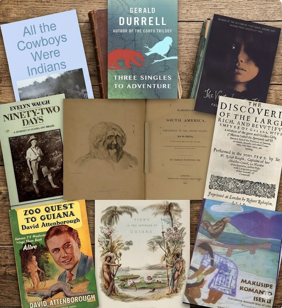
The first Europeans to write about the Rupununi built a series of myths around it. In 1596, Walter Ralegh wrote fancifully of the region in “The Discoverie of the Large, Rich, and Bewtiful Empyre of Guiana, with a Relation of the Great and Golden Citie of Manoa,” written to justify his voyage and promote English expansionism by casting Guiana as a gold-rich imperial prize. Based largely on second-hand reports, the book described a great freshwater lake in the interior. Ralegh asserted that near Lake Parime stood Manoa—a wealthy city rich in gold, ruled by a powerful monarch—and these locations persisted on maps for roughly two centuries.
Charles Waterton traveled through the Rupununi on expeditions between 1812 and 1824. In his 1825 book Wanderings in South America, he emphasized the transition from forest to wide grassy plains and marshy flats, and noted landscapes shaped and inhabited by Indigenous peoples. He also argued that Lake Parime had never existed, suggesting the idea arose from seasonal flooding of the Rupununi savannahs. Robert Schomburgk’s work in the region (1835–1839) finally debunked Raleigh’s claims; in 1840, he likewise concluded that “Lake Parime” was likely a seasonal inundation. In Twelve Views of Guiana, Schomburgk included four images from the Rupununi: Makushi Annai Village; Ataraipu Mountain on the Essequibo River; Pirara and Lake Amucu; and the Wapishana village of Watu Ticaba. He also formally described the giant water lily he named Victoria regia (later Victoria amazonica), exhibited at the Crystal Palace during the Great Exhibition of 1851. Waterton and Schomburgk transformed the Rupununi in the world’s eyes from a legendary landscape of gold and illusion into a visible, measurable, and scientifically knowable place—replacing myth with geography, wonder with explanation, and fantasy with enduring reality.
A defining feature of these expeditions was reliance on Indigenous knowledge, skills, and logistics. The reliance on Indigenous knowledge was systematic, even if credit rarely followed. Ralegh’s interior descriptions drew heavily on second-hand Indigenous accounts of routes, ecology, and geography, and his river travel depended on Indigenous guides. Waterton likewise relied on local expertise throughout his journeys, noting that his guides identified many birds, reptiles, and mammals for him. He traveled to Guiana to obtain wourali (curare) without knowing how to make it; without trust and instruction, he could not have procured or understood it. His work helped establish curare’s role as a neuromuscular blocker more than a century before its clinical use in modern anesthesia. Schomburgk’s boundary surveys, too, would not have been completed without Indigenous guides, river pilots, traditional knowledge, and transport support. Waterton and Schomburgk encountered the Rupununi through Makushi, Wapishana, and Arekuna communities whose ecological knowledge, guidance, and labor transformed the region from a European myth into a mapped, inhabited, and scientifically understood landscape.
Giants, Distance, and Global Standing on the Frontier
Evelyn Waugh traveled through the Rupununi in 1932–33; Gerald Durrell in 1950; David Attenborough in 1954–55; and Stan Brock lived there from the 1950s onward. Collectively, their accounts shifted the Rupununi in the global imagination—from little known to vividly peopled and biologically extraordinary. Waugh wrote about his journey in Ninety-Two Days, portraying the region as on the “edge of the empire,” and later drew on it in A Handful of Dust and the short story “The Man Who Liked Dickens,” inspired by his meeting with a certain Mr. Christie in the Rupununi. Waugh, Brock, and Durrell all described the difficulty of travel in those days: Waugh found the Rupununi hostile; Brock treated insects and malaria as the cost of working the land; and Durrell regarded them as minor inconveniences within a fascinating landscape.
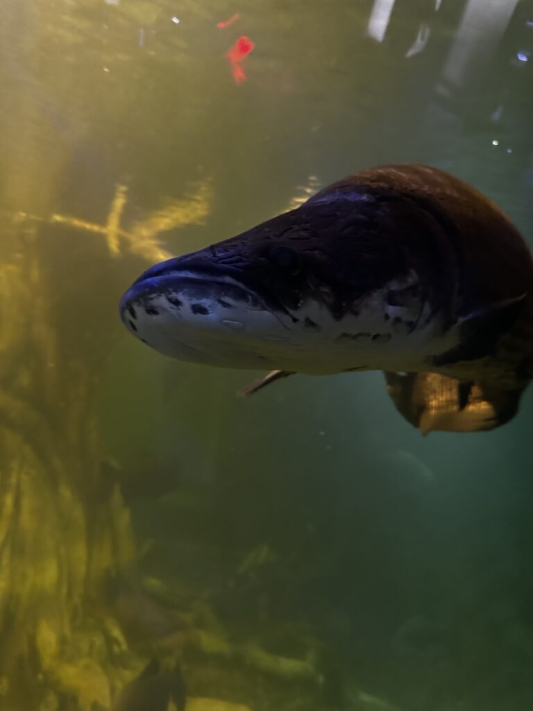
David Attenborough and Gerald Durrell were captivated by the region’s wildlife—its “land of giants”: giant anteaters, giant river otters, jaguars, anacondas, and harpy eagles. Attenborough’s film also featured caiman, macaws, hoatzins, Arapaima, electric eels, manatees, and sloths. Both men traveled to Guyana to collect animals for zoos (the London Zoo and the Jersey Zoo, respectively), including anacondas, iguanas, capybaras, peccaries, electric eels, sloths, and anteaters. The publisher’s description of Attenborough’s 1956 book Zoo Quest to Guiana refers to “some of the strangest, some of the loveliest, and some of the most horrifying animals in the world.” Both Attenborough and Durrell depended on Indigenous knowledge for access, safety, and locating animals—support without which outsiders could rarely navigate or operate effectively in the environment. Their books and broadcasts reached large audiences, in the millions, in the UK and internationally, and helped fix Guyana’s Rupununi in popular imagination.
Wild Kingdom in the 1960s also featured the Rupununi in an episode called “The Giants of Dadanawa,” with Stan Brock and Marlin Perkins wrestling an anaconda. Brock arrived in Guiana in 1952 at age 17, worked on Dadanawa Ranch, and later became a bush pilot. In 1968, he participated in the filming of Wild Kingdom in Guyana. He also wrote Jungle Cowboy (1969), later republished as All the Cowboys Were Indians. Mutual of Omaha’s Wild Kingdom attracted over 30 million viewers per week in North America at its peak. Dadanawa Ranch was among the largest cattle operations in South America—larger than Rhode Island at its peak, with up to 6,000 head of cattle. Established by the Melville family in the late 1880s, it was consolidated in 1919 as the Rupununi Development Company. The “cowboys” were largely Wapishana vaqueros, who rode barefoot—an example of how the ranch depended on Indigenous labor and expertise. Diane McTurk, whose family established Karanambu Ranch in 1927, described the last cattle drives of the 1950s—thousands of head moved through jaguar country from the Rupununi savannahs to the upper Berbice—as an illustration of how completely the landscape shaped the lives of those within it.
Reclaiming the Narrative and Global Standing
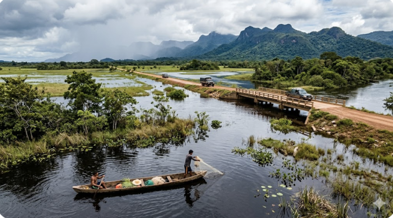
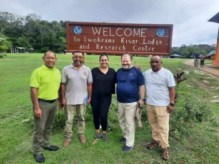
Scientists have long flocked to the Rupununi to document its species diversity, study the savannah-to-forest transition, and examine how two watersheds exchange ecologies across the northern and southern Rupununi portals. Visitors have come from the grandest global institutions, including the British Museum, the Royal Botanic Gardens, the University of Cambridge, the Smithsonian, Oxford University, the Academy of Natural Sciences in Philadelphia, the Royal Ontario Museum, the Open University, and the Field Museum of Natural History in Chicago. As in the past, much of this work has depended on the knowledge, skills, and field support of Indigenous communities. Over time, that collaboration has intertwined Indigenous knowledge with Latin scientific naming and contributed to the deconstruction of older colonial framings of the region. Work has included baseline inventories, long-term forest dynamics, and sustainable forestry, as well as population studies of black caiman, giant river turtles, giant river otters, and Arapaima.
Since the 1990s, the Makushi and Wapishana have steadily recaptured the Rupununi narrative. That shift has included formalizing traditional ecological knowledge and resource management within contemporary governance systems, and rebuilding stories and elder teachings about stewardship. It has also involved reconnecting with language through work such as the Makusipe Komanto Iseru, which examined Makushi social life, material culture, and ethnobiology, and Iwokrami Pantoni, a collection of Makushi-language stories about Iwokrama. Pauline Melville’s The Ventriloquist’s Tale is a fascinating book that brings together myth and history to explore the interactions between Indigenous cosmology, colonial legacy, and modern rationalism.
Across the Rupununi and Upper Essequibo, the Makushi, Wapishana, and Wai-Wai peoples are playing an increasingly decisive role in shaping Guyana’s most effective Indigenous-led conservation landscape. Their stewardship has supported the creation and management of protected and conserved areas, where community institutions translate customary land governance into contemporary conservation practice. The North Rupununi District Development Board (NRDDB) has helped drive landscape-scale conservation by supporting the establishment and co-management of protected areas, advancing sustainable livelihoods, and partnering with national agencies and international research institutions. In the South Rupununi, the South Rupununi Conservation Society (SRCS)—recognized with international conservation awards—has demonstrated how Indigenous governance can deliver measurable biodiversity outcomes through wildlife monitoring, environmental education, and community-based research. Complementing this work, Caiman House has become a model Indigenous-led research and conservation center known for long-term studies of black caiman, freshwater turtles, and wetland ecosystems, and for integrating scientific methods with Makushi and Wapishana ecological knowledge. Together, these institutions have helped transform the Rupununi from a remote frontier into a globally significant example of Indigenous-led conservation, high-quality research, and locally defined protected-area outcomes. Conservation work is complemented by Indigenous-led ecotourism in Rewa, Surama, Annai, and Yupukari, as well as tourism enterprises in Iwokrama, Karanambu, Rockview, Dadanawa, and Wichabai. Three decades of community-based work have expanded managed landscapes by an estimated 150,000 hectares (based on data from Iwokrama, NRDDB, and SRCS monitoring records), helped recover key wildlife species, and established biodiversity monitoring systems that support Guyana’s Low Carbon Development Strategy.
The Stakes of Rupununi’s Global Standing
The Rupununi is no longer a place that can be understood—or governed—only through domestic lenses. Centuries of writing and filmmaking have made it a symbolic landscape in which national choices signal stewardship, rights, and credibility.
For policymakers, that visibility changes the stakes: the world will watch decisions about land, wildlife, tourism, and investment and interpret them against the region’s Indigenous-led conservation record—and the expectations it has helped set worldwide. The practical question is not whether the Rupununi will fit within a global storyline, but whether Guyana’s institutions will align on land-use, conservation, and investment decisions in ways that strengthen the governance that has made the region resilient. Guyana’s global standing will rise or fall with how well those choices are made.
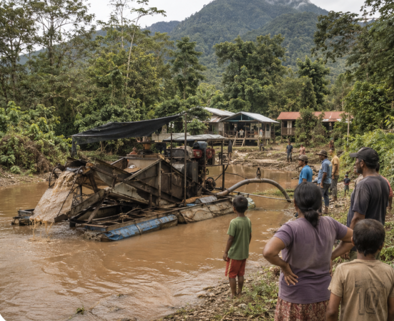
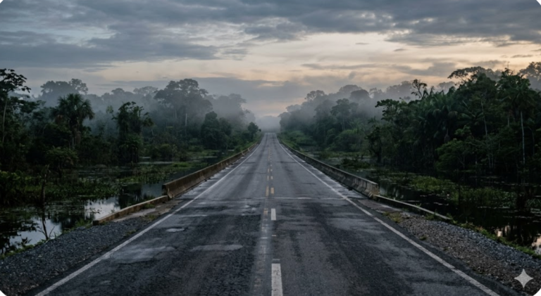
The risk of delay is not only ecological; it is also institutional, as uncertainty and fragmentation can narrow options and raise the costs of course-correction later. Growth in agriculture, mining, and tourism — and the completion of the Georgetown-Lethem Road — should be structured against concrete frameworks: Free, Prior and Informed Consent for land decisions affecting Indigenous communities, Performance Standards for private investment, and REDD+ protocols that tie carbon-value claims to verified land governance outcomes. The Rupununi’s future will be shaped as much by the stories that travel as by policies. Treating its global standing as an asset worth safeguarding—rather than an afterthought—can help reframe today’s debate over what must be protected, who must be empowered, and which risks are unacceptable to ignore. In that light, the Rupununi is an opportunity for Guyana to lead with confidence: to show that development and stewardship can reinforce each other when institutions are coherent, and communities are genuine partners. The broader framework for how LAC countries build these institutional foundations is explored in Watkins Advisory and, for the technological transition dimension, in The Next Wave by Graham Watkins.
Explore the Rupununi
Dive deeper into the Rupununi’s natural and human world. Explore the region’s ancient geology and Guiana Shield, the remarkable wildlife of the Rupununi, the rich history of human settlement, and the living culture of the people of the Rupununi. Learn more about the authors behind this companion site, and follow the latest thinking on conservation and development in the Rupununi Blog.
Discover more from Rupununi: Rediscovering a Lost World
Subscribe to get the latest posts sent to your email.

Such a thought provoking piece and a beautiful breakdown of historical accounts
Many thanks!
Thank you for this beautiful piece!
My pleasure – thanks for the feedback