
Finish the Rupununi Map Before Paving
Paving will reach Mabura before the Rupununi is ready.
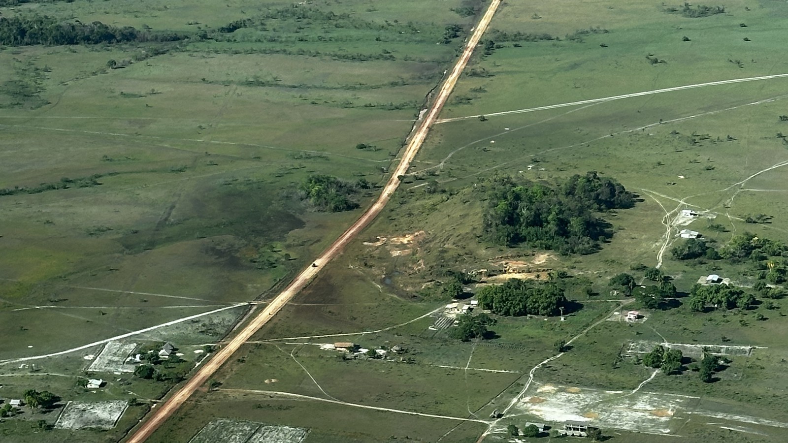
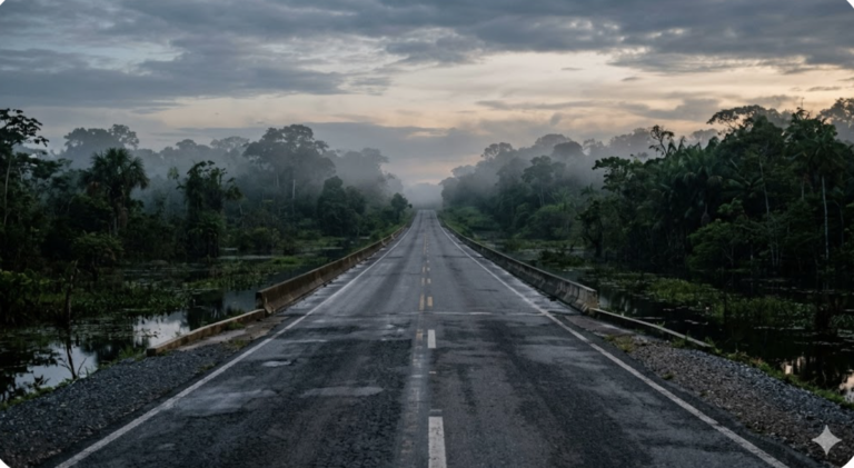
Paving the Georgetown-Lethem Road continues toward the Rupununi. The region is still not ready for what is coming. The paved section now runs south from Linden toward Mabura. Once the whole road is paved, it will take 4 hours to go from Linden to Lethem. This cuts the time down from at least 12 hours on a good day. The 2026 budget speech said 85 km of the road was already paved. Budget 2026 also allocated G$7.6 billion (US$36.5 million) for the Mabura-Kurupukari section. The Kurupukari-to-Lethem section is unpaved laterite, and various stretches in Iwokrama and from Annai to Lethem seasonally flood, becoming impassable.
Guyana has drafted regional land-use plans since 2004. As development spreads beyond Georgetown and the East Bank, Berbice, Essequibo Coast and Demerara-Mahaica, and Linden, these plans will become increasingly important. East Berbice-Corentyne (Region 6) has a Cabinet-approved plan covering the region’s north, and the Takutu-Upper Essequibo (Region 9) regional government is working from a locally agreed 2021 plan. Both plans let residents, local government, and national government agree on land use in advance, so they can address permitting conflicts before they arise.
This post looks at where we are with the road and land use management timetables along the Georgetown-Lethem Road. It sets out what the regional government and its villages have already done. It then asks what Cabinet and Parliament could change to ensure that permits follow regional plans and national policy. The post concludes with two actions that don’t require legislative change: controls for the road’s area of influence and a public permit registry.
Road builders and land agencies are not synced.
The Ministry of Public Works is building the road on an urgent timetable that the land management agencies do not appear to share. Timing matters. The paving of BR-319 in Brazil has been in the news since 2021. In 2021, deforestation in the area increased by 41% after the Brazilian federal government announced the paving. In April 2026, the Brazilian government issued four paving tenders, and paving this road became a major campaign issue in the elections.
The Caribbean Development Bank’s (CDB) loan documents set the original finish date for the Linden-Mabura section as June 2024. By September 2026, the Minister for Public Works said this section was 80% complete. The government manifesto commits to delivering the Kurupukari Bridge, over 600 m across the Essequibo, during this five-year term. So, the road is advancing on its own timetable. The agencies responsible for land use planning and management have no timetable.
Residents backed paving but want a management plan.
The CDB financed the Linden-Mabura section of the road. Its loan includes an environmental impact study and an Indigenous Peoples Plan. The official assessment does not cover indirect, induced, and cumulative impacts, so it sets no land-use plan requirement. In 2010, the Ministry of Public Works commissioned an Indigenous Peoples Plan for the entire Georgetown-Lethem Road. That plan indicates that 88% of the 356 residents surveyed in the North Rupununi backed paving the road. However, they added that the road needed a management plan that gives communities roles in decision-making, management, and monitoring. Villagers from Surama tied their support to a well-developed plan between communities and the government. Such a plan would help people control potential problems.
The first road upgrade to laterite in 1989 increased pressure from coastlanders and Brazilian miners. For twenty years, residents have raised concerns about rising road accidents. They were also concerned about illegal hunting, fishing, and trapping, human trafficking, HIV/AIDS, and illegal drugs.
The Lands Commission issued leases without adopting the corridor map.
The Guyana Lands and Surveys Commission (Lands Commission) drafted a corridor map in 2006, but did not adopt it. Yet in 2018, the same commission accepted applications for land grants of up to 30 acres along the corridor. A 2014 study for the Ministry of Public Works recommended a land-use plan to manage the road’s area of influence. Later, environmental and social impact assessments repeated this recommendation. The state owns 85% of Guyana’s land. Three agencies govern land use: the Lands Commission for agriculture and other leases, the Guyana Forestry Commission (GFC) for forestry, and the Guyana Geology and Mines Commission (GGMC) for mining. None of these agencies must check a regional plan before issuing a permit.
Paving will bring in miners and farmers.
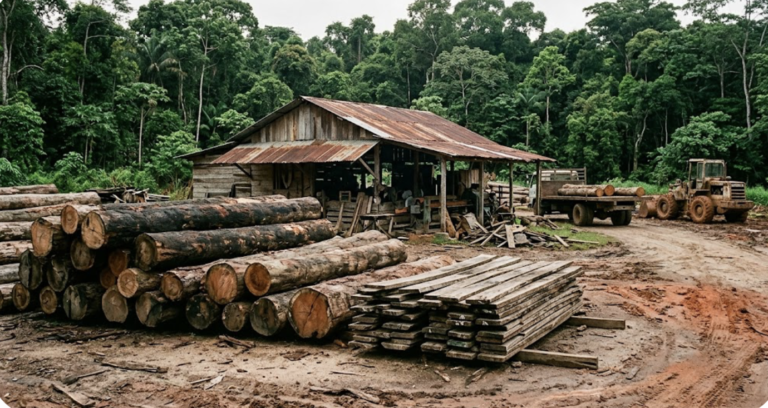
Paving the road will accelerate interest in gold and agricultural concessions along the road. Gold rose from US$1,943 an ounce in 2023 to US$4,411 in August 2026; Guyana is experiencing a gold boom on top of its oil boom. Elevated gold prices are already attracting Brazilian garimpeiros to the Iwokrama Forest. GGMC and the Guyana Police Force arrested illegal miners there in April 2025 and June 2026.
The Ministry of Agriculture’s 2024 investment prospectus sees large-scale agricultural investment in the Rupununi as central to national development. Large-scale farming is already underway in the Rupununi through the Santa Fe 11,700-hectare lease. Amerindian leaders told the authors of the 2010 Indigenous Peoples Plan that large-scale agribusiness would harm the region’s fragile ecosystems, citing cross-border damage in Roraima. Yet, the 2014 road assessment found no up-to-date regional mining or agricultural development plans to help gauge potential indirect impacts. The region’s own plan backs small farms, agricultural processing, forest products, and community tourism, not the large-scale agriculture the national prospectus describes.
Across tropical forests in Brazil, Colombia, Ecuador, Peru, and Bolivia, 95% of deforestation occurs within 5.5 km of roads or 1 km from rivers. The 2014 road study estimated this would put US$12.4 million in annual forest-carbon payments at risk. Carbon credit sales under the Low Carbon Development Strategy (LCDS) and the Hess agreement are now far larger, so deforestation along roads poses a much higher revenue risk. Paved roads also accelerate overhunting and overfishing risks to the wildlife ecotourism depends on and increase the need for improved safety measures and roadside facilities.
Village maps extend beyond titled lands.
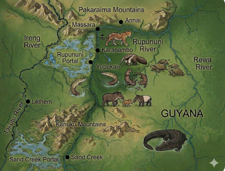
The Makushi and Wapishana claimed all the lands they used before the 1969 Amerindian Lands Commission report. For example, Annai claimed all the land between the Rupununi, Rewa, Essequibo, and Siparuni Rivers. The Amerindian Lands Commission called these and similar claims excessive, so it reduced them to village freehold areas. In my view, this reflects a Western idea of intensive land use. Farms in Annai, Massara, or Yakarinta can be a week’s paddle from the village and are often crucial during intense dry seasons. Across Guyana, the Amerindian Lands Commission recommended 24,000 square miles for 128 communities, down from the 43,000 they requested. The Commission left village lands fragmented, and many villages dissatisfied with their titles.
Since then, the villages have mapped their land use and lands numerous times, always well beyond the existing title. In the South Rupununi, the Wapichan have developed broader plans and village agreements that set aside the proposed Wapichan Conserved Forest. They proposed that the government share national zoning and development plans and consult more with local communities.. The Wapichan have established monitoring systems that found 385 harmful activities between 2013 and 2018, mainly caused by mining.
In 2022, UN experts noted that the 2006 Amerindian Act limits free, prior, and informed consent mainly to titled lands. This means the GGMC can issue mining permits over untitled but used lands without Indigenous consent. Even on titled land, the Act lets ministers override a village refusal of large-scale mining. In 2017, villages used the North Rupununi District Development Board to ask the Minister of Natural Resources to pause any new leases and concessions that might affect the wetlands.
Protected-area and village plans do not bind permits.
Iwokrama, the Kanuku Mountains, and villages all have plans. Yet the Lands Commission, GFC, and GGMC can issue agricultural, mining, and forestry permits that might affect these areas. The Iwokrama Act and planning process establish a Wilderness Preserve and Sustainable Utilization Area. The Kanuku Mountains 2024-2028 plan lists the land-use plan as unfinished. Kanashen’s village rules are gazetted in the Kanashen Community Owned Conservation Area plan. The plans are binding, but the Protected Areas Commission has limited finances and capacity to enforce them.
Village carbon money, about US$69 million between 2023 and 2025, enters the communities through annual village plans, drawn from 10-year Village Sustainability Plans. However, these village plans are not necessarily linked to regional land-use plans. The Region 9 plan aimed to incorporate village improvement plans; 21 of the 57 villages had completed theirs. It is unclear whether the link between LCDS funds and village plans could serve as a basis for regulating other investments on or near Indigenous lands. The Lands Commission and regional council could build that connection into the regional plan.
The Region 9 plan survived two governments but is not binding.
The Region 9 council has developed a ten-year plan that two governments have left in place. The regional plan is the only document that applies the LCDS in the region. In June 2015, the then President asked all regions to prepare regional plans. Region 9 began the process in October 2016 and had a planning unit and consultation process in place by 2018. After the 2020 election, the regional council completed the plan in April 2021 and tied it to the LCDS. The plan aligns with the Constitution, which requires each regional council to link its regional program to national development plans.
Under present law, regional plans are advisory, while protected-area plans and permits are binding. The Local Democratic Organs Act of 1980 lets regional councils make plans consistent with national policies and objectives. Budgeting constraints meant that no regional council produced a regional plan until 2004. The Act also does not give those plans authority over national permitting processes; they remain bound by national policy. The Lands Commission has a statutory mandate for land policy and planning and views the fragmented policy framework as a challenge. A National Land Policy would define who sets land use and how. The Region 9 plan gives the Lands Commission a key role in preparing the land-use map. Under the 2011 Act, the Protected Areas Commission prepares plans with binding zoning and gazetted rules.
Permits don’t answer to the regional plan.
No law requires decisions on mining, agriculture, tourism, or building to align with regional planning. Region 9 requested a register and map of existing mining operations and their permits. It also asked for a full map of all mining areas, showing land-use and tenure, before zoning. Lethem has a 2005 town plan, but it leaves zoning to a second phase. Yet the 2026 budget funds an airport, a fruit processing hub, and housing in Lethem without any regional or town mapping process.
Give the regional plan legal force and finish its map.
Parliament would need to amend the planning laws so that officially approved regional plans bind the permitting processes. This would mean that the GGMC, GFC, and the Lands Commission would cross-check the regional plan before issuing a permit.
The Lands Commission listed four regional plans between 2004 and 2007. To date, Cabinet has approved only one sub-regional plan, after a steering committee and the regional council endorsed it. I could not find evidence that this Cabinet-approved plan affected any permitting decisions. The Region 9 plan sets out which activities can happen and where, agreed nationally and locally. A land-use map would put these agreements on the ground. Both the Forests Act (2009) and the Protected Areas Act (2011) provide a legal route for designating protected areas. To date, regional plans remain in legal limbo, as well-consulted documents with no legal force. A National Land Policy, proposed in 2018 by the Lands Commission, could clarify who allocates land and how.
Efforts to manage the road corridor have stalled.
I have worked on this road since 1996. Throughout, the Makushi and the Wapichan have asked to be involved in planning, designing, managing, and monitoring the road. Most management efforts have stalled before adoption. No one adopted the 2006 Lands Commission corridor map or the corridor plan proposed in the 2014 road study. The 1996 National Development Strategy called for a National Land Policy. The Lands Commission drafted one in 1998, circulated a second in 2004, and a third in 2007. Cabinet adopted none of these policies, and the fourth, begun in 2018, remains a draft. The Inter-American Development Bank financed technical consultants who proposed creating an authority that would manage the road corridor, but the authority was never created.
The Lands Commission, GGMC, and GFC each retain their own permitting powers. These agencies issue titles for different purposes often over the same land. Controlling investments within the road’s direct area of influence could limit deforestation without waiting for new legislation. Given the institutional record, more immediate steps could include a public registry of leases, concessions, and titles, as requested in the Region 9 plan.
The Iwokrama road management plan was a pilot.
One stretch of the road has a plan. Iwokrama has managed the road under a plan since around 2002. The plan was written for a laterite road carrying 6 to 12 vehicles per day. Parliament excised the road from the Iwokrama Forest, but the Iwokrama Act requires Iwokrama to prepare corridor plans. The Ministry of Public Works would coordinate corridor management. The road management plan puts ranger stations at both points where the road enters the forest. The plan calls for night patrols, vehicle searches, and monitoring water quality at the 16 bridges and 33 culverts. The plan tracks wildlife and invasive species and proposes a Road Management Authority made up of government, community, and the private sector. The cost would be about US$2,400 per kilometer per year, with road tolls proposed to cover half of these costs. The road plan was written with the Linden-Lethem corridor in mind but was never followed through.
Two steps could limit damage without legal changes.
The road is moving faster than the region can manage the consequences. Rupununi Amerindian leader Sydney Allicock said, “We must prepare ourselves to use the road (wisely), so that the road does not use us.” Paving the road will further open access for mining, agriculture, tourism, and people moving along it. Villages have their maps and the region has its plan. The regional council needs to link its plan to village plans below and national plans above. The missing piece is a requirement that the Lands Commission, GGMC, and GFC review these plans before issuing future permits. Cabinet and Parliament could strengthen the Region 9 plan’s legal basis by finalizing the National Land Policy.
Until then, two steps could help manage consequences. First, the environmental and social assessments can set the rules for the direct area of influence. Second, the Lands Commission, GGMC, and GFC can put all current leases, concessions, and permits in a public register. Both actions could slow mining and agriculture permits today. But every lease, concession, or permit granted before the register is in place is a source of future conflict.
Discover more from Rupununi: Rediscovering a Lost World
Subscribe to get the latest posts sent to your email.
3 Comments